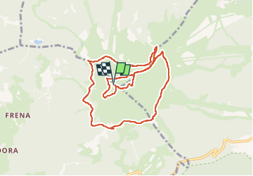
![](/images/other/stat-length.png)
![Randonnée Marche Marèo - Enneberg - Marebbe - Kronplatz - Plan de Corones 2275m - Photo](https://media.geolcdn.com/t/1900/400/d70beabe-4a7b-4f87-933c-d3ae0ecd21e8.jpg&format=pjpeg&maxdim=2)
Kronplatz - Plan de Corones 2275m
VacheKiri67
Utilisateur
![Longueur](/images/other/stat-length.png)
![Altitude max](https://static1.geolcdn.com/siteimages/upload/files/1508320355ic_sort_altitude_max_24dp.png)
![Dénivelé positif](https://static1.geolcdn.com/siteimages/upload/files/1508320355ic_sort_den_pos_24dp.png)
![Km-Effort](/images/other/stat-length.png)
![Altitude min](https://static1.geolcdn.com/siteimages/upload/files/1508320355ic_sort_altitude_min_24dp.png)
![Dénivelé négatif](https://static1.geolcdn.com/siteimages/upload/files/1508320355ic_sort_den_neg_24dp.png)
![Boucle](https://static1.geolcdn.com/siteimages/upload/files/16400158638029165_repeat_loop_refresh_sync_direction_icon.png)
![Marche](https://static1.geolcdn.com/sitytour/trail-icons/101.png)
3h47
Difficulté : Facile
![Scannez ce code QR pour ouvrir la randonnée dans l'application SityTrail](https://capi.geolives.com/qq0zvz2zws4bq2lad0pu/sitytour/trails/3323173/qr.png?size=200)
Application GPS de randonnée GRATUITE
À propos
Randonnée Marche de 9,8 km à découvrir à Trentin-Haut-Adige, Haut-Adige, Marèo - Enneberg - Marebbe. Cette randonnée est proposée par VacheKiri67.
Description
Faite le 20/07/2022.
Montée au sommet par télécabine depuis Bruneck - Brunico (Kronplatz 2000 de 945m à 2258m) mais d'autres possibilités existent. Notre parcours suit le balisage B = Concordia 360° (durée indiquée 3h, facile) puis une partie du A = Corones.
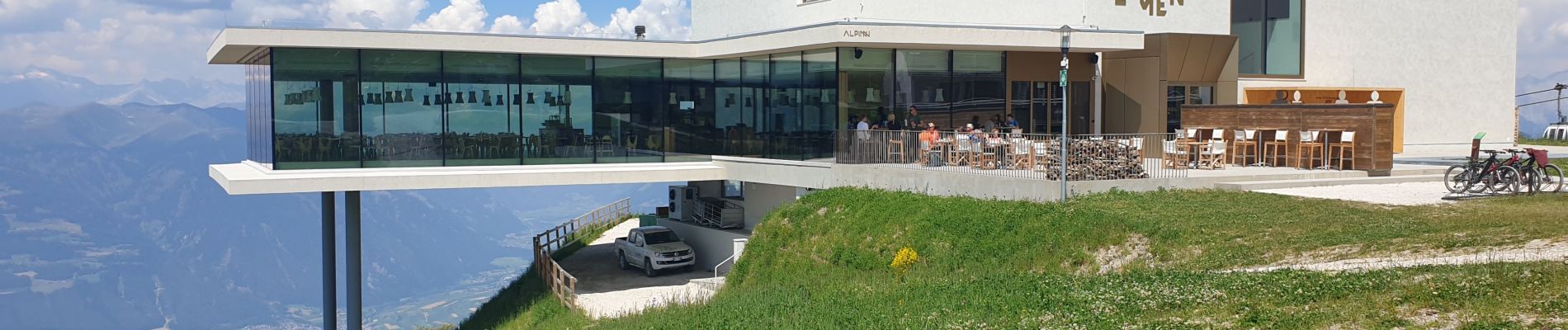
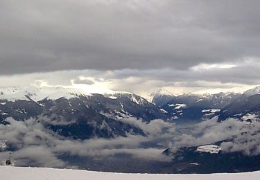
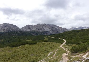
Localisation
Commentaires
Randonnées à proximité
![Randonnée A pied St. Lorenzen - San Lorenzo di Sebato - IT-1 - Photo](https://media.geolcdn.com/t/375/260/30894d3b-493c-4e2a-93e9-a56528d7dd33.jpeg&format=jpg&maxdim=2)
![A pied A pied](https://static1.geolcdn.com/sitytour/trail-icons/100.png)
A pied
![](/images/other/stat-length.png)
![](https://static1.geolcdn.com/siteimages/upload/files/16400158638029165_repeat_loop_refresh_sync_direction_icon.png)
![Randonnée A pied Olang - Valdaora - Rundweg Corones B - Photo](https://media.geolcdn.com/t/375/260/4fdc8508-f34e-4544-a9b6-c1c2eede477e.jpeg&format=jpg&maxdim=2)
![A pied A pied](https://static1.geolcdn.com/sitytour/trail-icons/100.png)
A pied
![](/images/other/stat-length.png)
![](https://static1.geolcdn.com/siteimages/upload/files/16400158638029165_repeat_loop_refresh_sync_direction_icon.png)
![Randonnée A pied Marèo - Enneberg - Marebbe - IT-24 - Photo](https://media.geolcdn.com/t/375/260/b2fcdca9-9772-4ed8-9d9c-ee54496d94ef.jpeg&format=jpg&maxdim=2)
![A pied A pied](https://static1.geolcdn.com/sitytour/trail-icons/100.png)
A pied
![](/images/other/stat-length.png)
![](https://static1.geolcdn.com/siteimages/upload/files/16400158638029165_repeat_loop_refresh_sync_direction_icon.png)
![Randonnée A pied Olang - Valdaora - Wanderroute 22 - Photo](https://media.geolcdn.com/t/375/260/a6c76e97-6544-4578-b017-12adead24f05.jpeg&format=jpg&maxdim=2)
![A pied A pied](https://static1.geolcdn.com/sitytour/trail-icons/100.png)
A pied
![](/images/other/stat-length.png)
![](https://static1.geolcdn.com/siteimages/upload/files/16400158638029165_repeat_loop_refresh_sync_direction_icon.png)
![Randonnée A pied Marèo - Enneberg - Marebbe - IT-21 - Photo](https://media.geolcdn.com/t/375/260/dbd6d690-288e-42dd-a7d4-a59ad11f37a4.jpeg&format=jpg&maxdim=2)
![A pied A pied](https://static1.geolcdn.com/sitytour/trail-icons/100.png)
A pied
![](/images/other/stat-length.png)
![](https://static1.geolcdn.com/siteimages/upload/files/16400158638029165_repeat_loop_refresh_sync_direction_icon.png)
![Randonnée A pied Marèo - Enneberg - Marebbe - Tres la Val - Photo](https://media.geolcdn.com/t/375/260/491f2ec3-6a70-4af3-8cd3-baaad084222d.jpeg&format=jpg&maxdim=2)
![A pied A pied](https://static1.geolcdn.com/sitytour/trail-icons/100.png)
A pied
![](/images/other/stat-length.png)
![](https://static1.geolcdn.com/siteimages/upload/files/16400158638029165_repeat_loop_refresh_sync_direction_icon.png)
![Randonnée A pied Marèo - Enneberg - Marebbe - IT-22 - Photo](https://media.geolcdn.com/t/375/260/967087a7-ac37-4d07-9a0e-74715fe6ef3b.jpeg&format=jpg&maxdim=2)
![A pied A pied](https://static1.geolcdn.com/sitytour/trail-icons/100.png)
A pied
![](/images/other/stat-length.png)
![](https://static1.geolcdn.com/siteimages/upload/files/16400158638029165_repeat_loop_refresh_sync_direction_icon.png)
![Randonnée A pied Olang - Valdaora - IT-7 - Photo](https://media.geolcdn.com/t/375/260/e198f3a8-5c60-4d86-865f-5ce351f18418.jpeg&format=jpg&maxdim=2)
![A pied A pied](https://static1.geolcdn.com/sitytour/trail-icons/100.png)
A pied
![](/images/other/stat-length.png)
![](https://static1.geolcdn.com/siteimages/upload/files/16400158638029165_repeat_loop_refresh_sync_direction_icon.png)
![Randonnée A pied Bruneck - Brunico - IT-5 - Photo](https://media.geolcdn.com/t/375/260/efc2a380-6eb9-42fe-979a-ee45c7be6b96.jpeg&format=jpg&maxdim=2)
![A pied A pied](https://static1.geolcdn.com/sitytour/trail-icons/100.png)
A pied
![](/images/other/stat-length.png)
![](https://static1.geolcdn.com/siteimages/upload/files/16400158638029165_repeat_loop_refresh_sync_direction_icon.png)